Learning Module: CUAHSI JupyterHub, TimeSeries Data
| Authors: | |
|---|---|
| Owners: | Clara CogswellEmily Clark |
| Type: | Resource |
| Storage: | The size of this resource is 5.3 MB |
| Created: | Jun 10, 2022 at 8:49 p.m. |
| Last updated: | Nov 21, 2023 at 6:26 p.m. |
| Citation: | See how to cite this resource |
| Content types: | Single File Content |
| Sharing Status: | Public |
|---|---|
| Views: | 1615 |
| Downloads: | 222 |
| +1 Votes: | Be the first one to this. |
| Comments: | No comments (yet) |
Abstract
This learning module is designed to help users, learners, and instructors learn how to operate on timeseries data in the CUAHSI infrastructure ecosystem. The data contained in this resource was downloaded from Waquoit Bay National Estuarine Reserve's database. The readme file is supplied by WBNERR to accompany the data.
To use this resource, make a copy to your workspace using the "Copy this resource" option at the top right of the page. This will create a copy of the resource in "My resources" where it can be used and operated on independently from this original resource.
Subject Keywords
Coverage
Spatial
Coordinate System/Geographic Projection:
WGS 84 EPSG:4326
Coordinate Units:
Decimal degrees
North Latitude
37.5887°
East Longitude
-79.3158°
South Latitude
36.3511°
West Longitude
-83.2379°
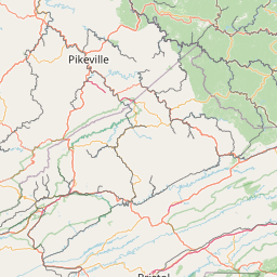


Leaflet Map data © OpenStreetMap contributors
Content
This resource contains links to external content. Linked content is
NOT stored in HydroShare, and we can't guarantee its availability, quality, or
security.
Additional Metadata
Related Geospatial Features
This HydroShare resource is linked to the following geospatial features


Leaflet Map data © OpenStreetMap contributors
Related Resources
| Title | Owners | Sharing Status | My Permission |
|---|---|---|---|
| CUAHSI Apps Learning Modules | Clara Cogswell | Public & Shareable | Open Access |
How to Cite
Cogswell, C. B. (2023). Learning Module: CUAHSI JupyterHub, TimeSeries Data, HydroShare, http://www.hydroshare.org/resource/79bcccc2295a4b7e886377218fdf8396
This resource is shared under the Creative Commons Attribution CC BY.
http://creativecommons.org/licenses/by/4.0/
Comments
There are currently no comments
New Comment